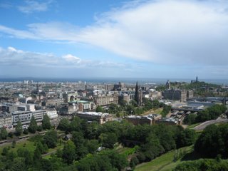
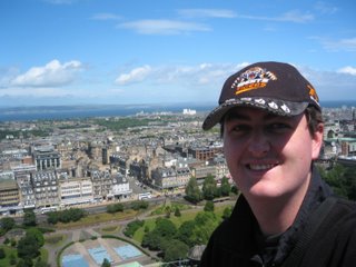
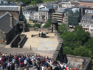
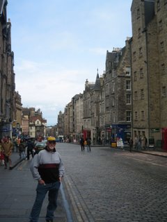
Or Scotland the Bloody Freezing, to be perfectly honest. I'm in Edinburgh at the moment, it's summer. Apparently. It's raining sideways, blowing a gale and the people in this town are wearing t-shirts. I know I sound, and no doubt look like a complete tourist by wearing winter woolies, but who cares! It's taken me 5 minutes just to thaw my fingers out to be able to type in this internet cafe. No wonder so many Scotsman join the military - if it was this cold in Australia I'd look for any excuse out as well. Call it Melbourne syndrome.
Anyways.
In the past few days, we've almost maxed out our quota of ye olde ancient English history. Last time I blogged, we were staying at a B&B, at the Vyvyan Hotel. Since then, we've discovered a motel chain called Travelodge, which is a much cheaper alternative to the standard B&B fare. Unfortunately, they don't have any internet access, and Britain's positively stone age approach towards broadband, let alone wireless, has made it impossible for me to get online. As a result, as mentioned, I've sought out an internet cafe in Edinburgh, to update the blog, and present a roundup of the last week or so.
Last time I blogged, it was Wednesday night. Let's do this, day by day. On Thursday, we left the Vyvyan and made our way to Tintagel castle (pronounced Tin-tadgel). This castle, constructed in the 13th Century, was built by the Earl of Cornwall, on a high, nearly inaccessible bluff above the Irish Sea, on the west coast of England. The sole reason for building the castle in such a remote location was that King Arthur, famous in legend, was reportedly born in the Tintagel area, and, as a result, any noble who built a castle there could tap into the power of that legend. One of the guides at the site described the castle as a "13th Century Disneyland" - the walls were washed with limestone, and it had been constructed in the most extravagant place possible - therefore the result was a castle that shone with white light and could be seen from miles away. The castle fell into ruin within a couple of hundred years however, as due to the remoteness, very few people desired to live there permanently, and the biting winds that blow in from the Atlantic Ocean, combined with monstrous seas, drove the remainder away. Even in summer the wind is cold - in winter, it would be simply appalling.

This is the island part of the castle, taken from the mainland. I should explain - the island part of the castle is separated by a very narrow channel from the mainland. The castle itself was located on the island, in the foreground, where the bulk of the ruins are. On the mainland was a great hall, which was used most often - the castle being reserved for ceremonial occasions.

This is the great hall, taken from the island. The steep cliffs in the area can be clearly seen - they have caused most of the damage to the castle over the years, as erosion has caused large chunks to fall into the ocean. Nowadays the cliffs are heavily supported to prevent further erosion of the castle.

This is the oldest building on the island, a 1000 year old chapel that already existed hundreds of years before the castle was constructed. You can see the altar in the centre of the chapel. The building behind is a hotel - an obvious mimic to the Arthurian taint that surrounds the area.

I snapped this photo at the nearby graveyard. This is the sort of cross I like to see. Funny thing - when I took this photo, I took it with the cross upside down. But when I viewed it on the computer, it had been inverted so that the cross was the right way up. I had to physically adjust the photo back to it's original upside down state. Perhaps somebody is trying to tell me something?

Me getting burnt by divine wrath when I rested my hand on the 1000 year old altar for a self-portrait. No doubt Craig will think this is entirely justified for my anti-religious sentiment expressed previously.
(Apologies to anyone offended by the above photos. It's more an inside joke between me and the guy I used to live with, as opposed to genuine church-bashing.)
Ahem. Moving right along...
After bidding adieu to Tintagel, we then made our way to Clovally, a fishing village like many others in Britain, with one exception. Clovally is built on the side of a hill that is so steep, no roads were ever built into the village. The only way to access it in times gone by was via cobblestone paths, for humans and donkeys - the main means of taking the fish from the village up to the roads at the top of the headland. It's been opened up to tourists, but the original cobblestone paths remain, which is good. It deters most of the fat, obnoxious americans from dragging their wheezing great arses down to the bottom. When we arrived the place was nearly deserted, as England was about to play Trinidad in the World Cup. Taking opportunity of the fact that half of England was glued to their TV sets, we drove up the nearly deserted motorway to Bristol, where we stopped for the night.
At Clovally, I managed to get a few photos though.

The main street, taken from the top of the hill.

The town, taken from the docks at the bottom of the town. It's hard to exaggerate the steepness of the climb - suffice to say if it were wet and you had a rubber mat, you'd probably make it to the bottom without any trouble if you went arse over while walking down.

England's excuse for a beach. That ain't sand folks - it's stones. Nice day though. Not much wind at all. Water was absolutely freezing though. Yet I had a Pom assuring me that this was a fantastic day for bathing, and wanting to know why I wasn't keen for a swim. I think I'll hang up my board shorts until I return home.

Found this cat in the town. Looks innocent enough, but reeked of fish - he'd been raiding garbage bags not 10 seconds before.

Now that Dan's got his new bike painted, I found another bike for him to ride to avoid the inevitable damage his bike would suffer due to his blithering incompetence behind the handlebars. Previous owner - an 11 year old with scraped knees.
The next day, Friday, we did the scenic route, travelling through an area known as the Cottswolds. This region of England is intentionally picturesque, packed full of all the quaint things that make England England, such as thatched roofs, tiny roads, churches, itinerant peasants and the weirdest names of towns you'll ever see. Suffice to say,'twas very nice. We had lunch by a little stream in a town called "Lower Slaughter," and then walked to "Broughton-on-Water", before motoring on to our next travelodge, in a town called "Catbrain."
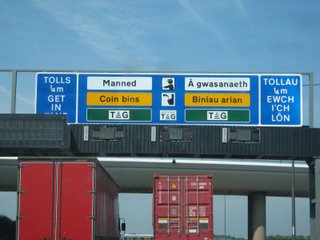
Before we made our way to the Cottswolds, we made a brief trip into Wales. You can tell it's wales, because they duplicate all the signs in Welsh. There's a reason the language isn't used anymore people - STOP TRYING TO KEEP IT ALIVE!

I honestly can't remember where I got this photo of the old post office. I think it could be Tintagel, or not. I can't remember. But it's a good example of the decrepit sort of stuff you find in the Cottswolds. If you had to sum it up with a single world, it would be archaic.

'Nuff said. They have these signs EVERYWHERE in the Cottswolds, and with good reason.

Standard sort of street signs for the area. While the council budget does extend to erecting new speed cameras, it obviously doesn't extend to replacing direction markers. Some of the milestones have been in place since the 1700's.

Highland cattle in a small creek we passed. These cattle come equipped with what should be standard equipment on someone like Jeanette Howard - a 2 foot fringe.

An old barn - still in use though. It's somewhat disheartening to think that some crappy barn, was built 100 years before your home country was even discovered by white people and is still standing when you finally make your way over to England to photograph it.
Saturday was a very special day, mainly for the oldies, but also for Anna and I as well. For years, well, ever since I can remember, we've received letters and birthday cards from a couple in England called Phil & Beryl, who Mum & Dad met when they were over in England in the 1970's, when they worked as fruit pickers. Finally, after 23 birthday cards from these people, we finally got to meet them, which was fantastic. For a couple who are both in their 80's, they're remarkably spry. We had lunch, and spent most of the day catching up, checking out their fruit orchard and gardens (Phil is a gardener par-excellence), and having a great old time. Phil has some great wartime memorabilia - he was an air gunner on a Lancaster Bomber, and had some jaw-dropping stories about raids over Germany and whatnot. Very interesting chap. Alas, we eventually had to bid farewell, and head off.
Sunday was a day of meeting more people that knew the oldies when they weren't so old - when they had long hair, wore daggy clothes, drove around in a campervan, picked fruit and hugged trees. In England, Mum & Dad met a couple called Mick & Debbie, who regularly picked fruit at the same farm. Nowadays they live in a town called Sutton Bridge, near Norfolk county. We trekked up a winding maze of A-Roads to get there, had a delicious lunch and a chat, walked around the town and through the countryside, before heading off, ever northwards.
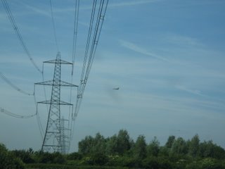
We were buzzed by a jet on the way to Mick & Debbie's place - the RAF, unlike the RAAF don't have the luxury of being able to fly over uninhabited tracts of land, so they fly over inhabited tracts instead. By the time I managed to get the camera out he was a fair distance away, but he was bloody close when he roared overhead.

Group Photo. Back Row, Left to Right: Dad, Mum, Mick, Debbie, Jo (their son).
Front Row: Me, Shelley (their daughter), Anna.
Monday was a long day. We left the town of Sleaford, where we'd stopped on Sunday night, and wound our way up the east coast of England, through towns such as Lincoln, Scarborough & Whitby. On the way we saw an airbase that was both historical and modern, at Waddingham. On one side of the road was the old airbase, where Spitfires and Mustangs flew out of during the war, while on the other side of the road was the modern airbase, with a Vulcan bomber parked on the tarmac as a display, along with several AWACS aircraft and transports. Photos had to be taken at a distance, due to the presence of armed guards at the entrance packing huge machine guns.

The Vulcan bomber on display. You can see how the Yanks derived their inspiration for the stealth bomber design from the Vulcan's wing shape.

AWACS aircraft parked on the tarmac. They essentially act as fighter controllers in the air, picking up information on their gigantic radar domes, and then directing the fighter jets to their targets.
Not long after that we made our way across the Humber Bridge, which, for a time, was the longest suspension bridge in the world, until the Japs felt the need to start linking their islands up. Apart from these few stops, most of the day was spent driving - unless you're on the motorways, it takes a long time to get anywhere in England. The main roads between towns tend to be one lane each way, and are winding, hilly, full of blind corners and normally have a caravan or a horse float doing 10 miles below the limit slowing everyone else up. This can get somewhat frustrating, and, dare I say, monotonous after a while. So, to break it up, and make it sound more entertaining, here's some more pictures.
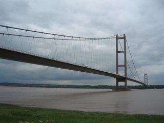
The Humber Bridge. What can you say - it's a bridge, isn't it? You get what you pay for - in our case, a two minute journey for 2 pounds 70.

A view from underneath. In America, this sort of bridge would be surrounded by armed guards and landmines. In Britain, it's surrounded by dog turds along the walking track underneath.
Despite all this, the day ended on a very special note for the Dawson clan.
In a little town called Marske-by-the-Sea, we knew that Dad's side of the family (the original Dawsons) had lived there before coming to England. The story, as best we know it, was that my great-grandfather Phillip Dawson left for Australia in 1906 at age 17, under questionable circumstances. My great-great grandfather, James Dawson, advised his son to leave England, for whatever reason, which he did, sailing from Whitby. Five years later, in 1911, James was killed in a mine cave-in at Upleatham Mine, at the age of 49. After arriving in Marske, we got directions to the graveyard from a local, and eventually located it, near the seaside. There, amongst a ruined church and hundreds of other graves, we found the following tombstone.


The second picture shows the graveyard as a whole. The tombstone in question is front centre, but you can see the ruined church behind it.

And that's what was written on the tombstone. The Dawsons have returned to pay their respects, James. This was a very special moment for the family, but it will mean the most to my grandfather, whose father, Phillip, often told him about James, who he never met.

The seaside near Marske. Again, you can see another example of what the Poms call a "beach."
Tuesday was the day set aside to visit Hadrian's Wall, or "Hadrian's Small Obstacle" as Meakin termed it, which wasn't far from the truth as it turned out. Forearmed with this knowledge, we decided to skip visiting the wall itself, preferring instead to make our way to the visitor centre and museum. This was a much better experience, with all the usual archaeological bollocks. We saw quite a few ruined buildings, or the foundations thereof, a replica section of the wall itself, as well as a museum where they've stashed all the coins, clothing, metal, pottery and other assorted junk that they've turfed out of the ruins over the last hundred years or so. At least they let you tramp around the ruins after paying the obligatory billion pounds here, as opposed to Stonehenge, where you need a set of binoculars and 20/20 vision to see anything. I have photos of it, but quite frankly it's boring as batshit unless you're actually walking around, so I won't bother chucking them up. Instead, you get a picture of an Aston Martin V8 Vantage that roared past us at a squillion miles an hour, and the old man freezing.

Poetry in motion.

The old man showing just how cold the wind is that's powering those windmills.
From the visitor centre at Hadrian's wall we followed the road that parallels the wall, saw various ditches and ramparts, crossed into Scotland, stopped in some town for a late lunch and nearly froze, and finally, arrived in Edinburgh for the night. Thus endeth the week. Today, we're roaming around Edinburgh city, which should make for interesting viewing. It's seriously bloody cold here though - Scotland's idea of summer is 10 degrees celsius, huge winds and driving rain. Proverbial brass monkey weather, as it were. However, we're soon back to London and somewhat warmer climes.
Now, while I am at Edinburgh, and have already been to the castle and whatnot, I'll save those photos, primarily since I left the cable that allows me to transfer photos onto the laptop back at the motel. Suffice to say it was cold, windy and absolutely fantastic. Scotland is indeed a fabulous place - very different to England. I fancy I could live here, but the cold would do for me in the end I think. Expect another update in London - I'll be back there in three days time, where hopefully it'll be warmer. I definitely need to get some winter woolies - at least they'll be cheaper in this so-called summer season.
Paul out.


